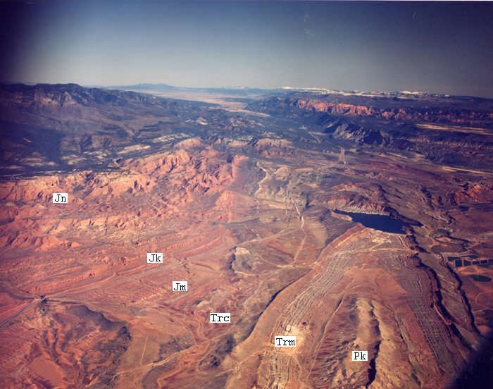
Oblique view of the Virgin Anticline (bottom right of photo) looking north. The anticline is plunging into the ground to the north. Units from youngest to oldest Jn = Jurassic Navajo Sandstone; Jk = Jurassic Kayenta Formation; Trc = Triassic Chinle Formation; Trm = Triassic Moenkopi; Pk = Permian Kaibab Formation.

Virgin River Anticline (Leeds area) by Utah Geological Survey is licensed under a Creative Commons Attribution-NoDerivatives 4.0 International License.
Permissions beyond the scope of this license may be available at https://www.flickr.com/photos/utahgeologicalsurvey/17177576122/